Client : Jabatan Pengairan dan Saliran Malaysia (JPS) 
In 2022, we had been appointed by Jabatan Pengairan dan Saliran Malaysia(JPS) to perform Underground utility mapping services across a total distance of 7 KM for riverbank reinforcement and stabilization projects, at Sungai Penchala, Petaling Jaya district.
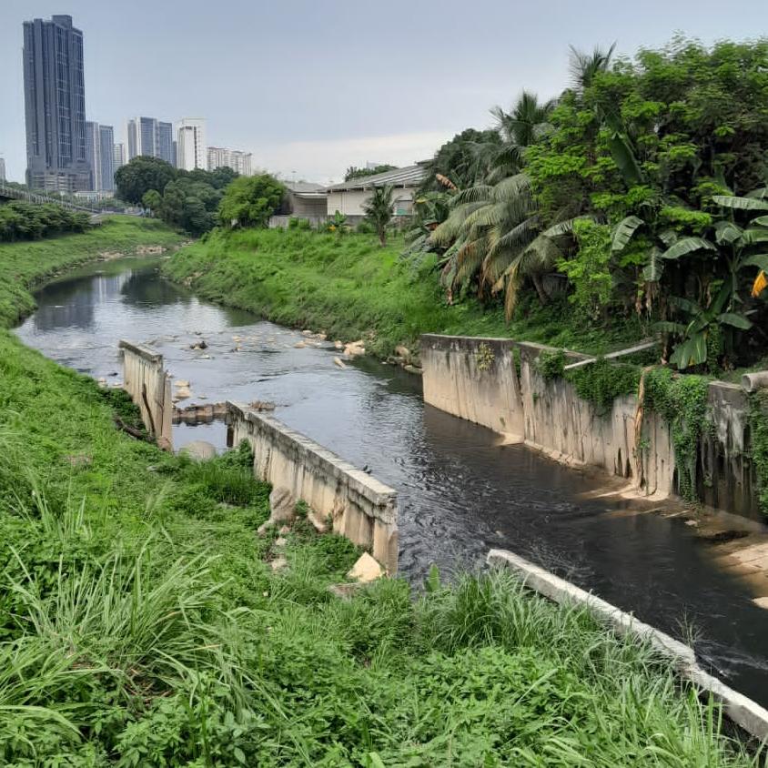
Fig.1 : River wall at Sg. Penchala, visually obvious a bit slanted and prone to collapsing
The residents living along Sungai Penchala face a growing problem of riverbank collapse, which poses a serious threat to their social activities and daily lives. This issue has been steadily increasing and is compounded by the fact that the river is no longer able to handle the runoff during heavy rains. The primary cause is the continuous development in the river's basin area, where various economic activities have led to the creation of large water impermeable surfaces. This development has significantly reduced the natural water absorption capacity of the land, making it prone to flooding.
The floods have severely impacted over 5,000 residents and more than 200 business premises, causing significant disruptions to daily life and economic activities. These challenges highlight the urgent need for sustainable development and flood mitigation measures to address the ongoing risks to the community and the environment along Sungai Penchala.

Fig. 2 : Google Earth image of Sg. Penchala
The underground utility mapping carried out by us along a total distance of 7 KM serves as a critical step in providing the necessary data and information required for the engineering design of the bank stabilization and flood mitigation efforts along Sungai Penchala. By identifying the location and condition of existing underground utilities, such as water pipes, sewage lines, electrical cables, and communication infrastructure, this mapping helps ensure that any construction or engineering work can be carried out safely and efficiently without damaging these vital services.
This mapping will support the planning and implementation of effective bank stabilization techniques at the critical hotspots identified by the Jabatan Pengairan dan Saliran Malaysia(JPS), particularly in the Petaling Jaya area. It will also be integral in the flood mitigation design to prevent further property losses and minimize flood risks to the affected residents and businesses. The accurate utility mapping will aid engineers in making informed decisions on how to approach the stabilization and flood control works, ensuring that they align with existing infrastructure and reduce the risk of unforeseen complications during construction.
The underground utility mapping was carried out using Electromagnetic Locator (EML) and Ground Penetrating Radar (GPR) technologies. Both of these methods are non-invasive and effective in identifying and locating underground utilities, ensuring a safe and accurate mapping process for the engineering design of bank stabilization and flood mitigation works along Sungai Penchala.
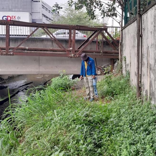
Fig. 3 : EML detection by the river
- Electromagnetic Locator (EML):
EML uses electromagnetic fields to detect conductive materials such as metal pipes, cables, and other utilities buried underground. It works by sending an electromagnetic signal through the ground, which is then reflected back from any conductive materials, allowing the locator to pinpoint the location and depth of these utilities. This method is particularly useful for mapping metallic utilities like water, gas, and electrical lines. - Ground Penetrating Radar (GPR):
GPR uses high-frequency radio waves to scan the subsurface and create images of underground features. The waves penetrate the ground and reflect off materials with different properties, such as pipes, ducts, cables, and even voids or cavities. GPR provides detailed information on the type, location, and depth of various underground utilities, including non-metallic ones, such as PVC pipes or concrete ducts.
By combining these two advanced technologies, the underground utility mapping provides a comprehensive view of the subsurface conditions along the riverbank. This data is essential for the engineering design process, as it ensures that any bank stabilization or flood mitigation work is carried out without interfering with critical infrastructure, reducing the risk of damage to utilities and ensuring the safety and effectiveness of the project.
The results of the underground detections carried out are presented in the survey plans that are submitted to our clients.
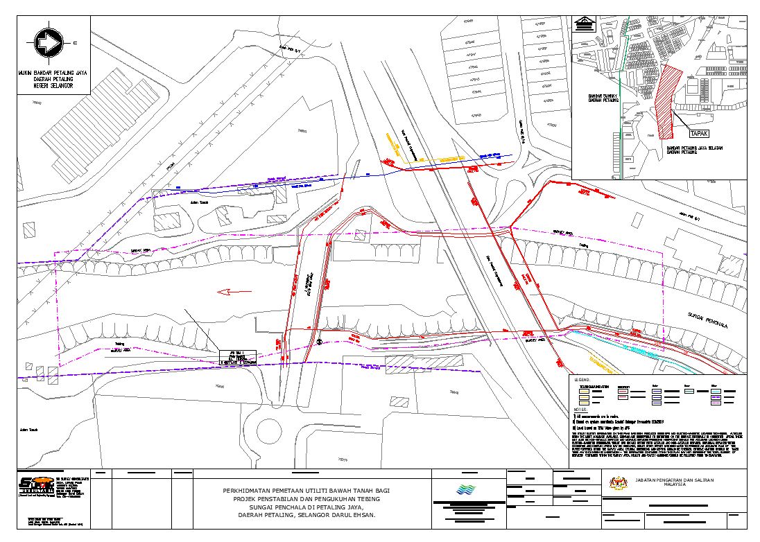
Fig. 4 : An example of one of the UUD survey plans produced
.
